Butterflies are sensitive to a great number of environmental factors. To make matters worse, those factors often interact with each other. Especially those processes which are connected with land use have a major influence on population trends and the composition of species communities. Besides, scientific studies portend that climate change will increase in importance. Like all insects, butterflies belong to the group of poikilothermic organisms whose activity and development is directly dependent on the temperature of their environment. These properties make them particularly sensitive to changes in temperature. Butterflies have very short development cycles; this makes them respond even faster to changing climatic conditions.
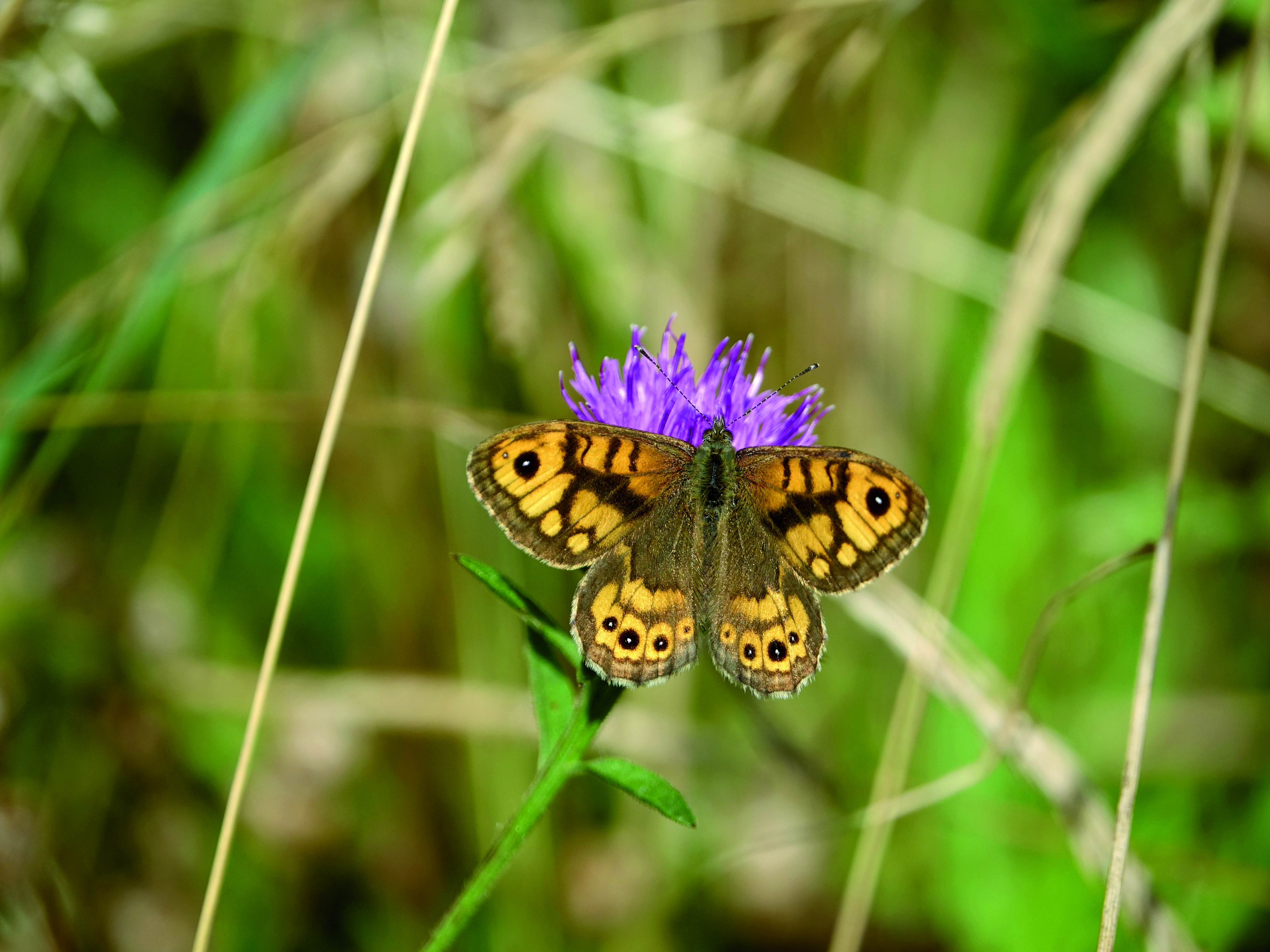
Germany has a wide range of native butterfly species which distinguish themselves by having different temperature requirements. This includes both, thermophilic species such as the marbled fritillary (Brenthis daphne) and the wall brown butterfly (Lasiommata megera) as well as psychrophilic species such as the ringlet (Aphantopus hyperantus) and the pearl-bordered fritillary (Boloria selene). In the course of climate-change related warming, the habitat conditions for species with requirements for higher temperatures are improving. On the other hand, species adapted to cool environments are confronted with unfavourable conditions. The tendency for increases in thermophilic species and the decline in psychrophilic species is changing the composition of localised species communities.
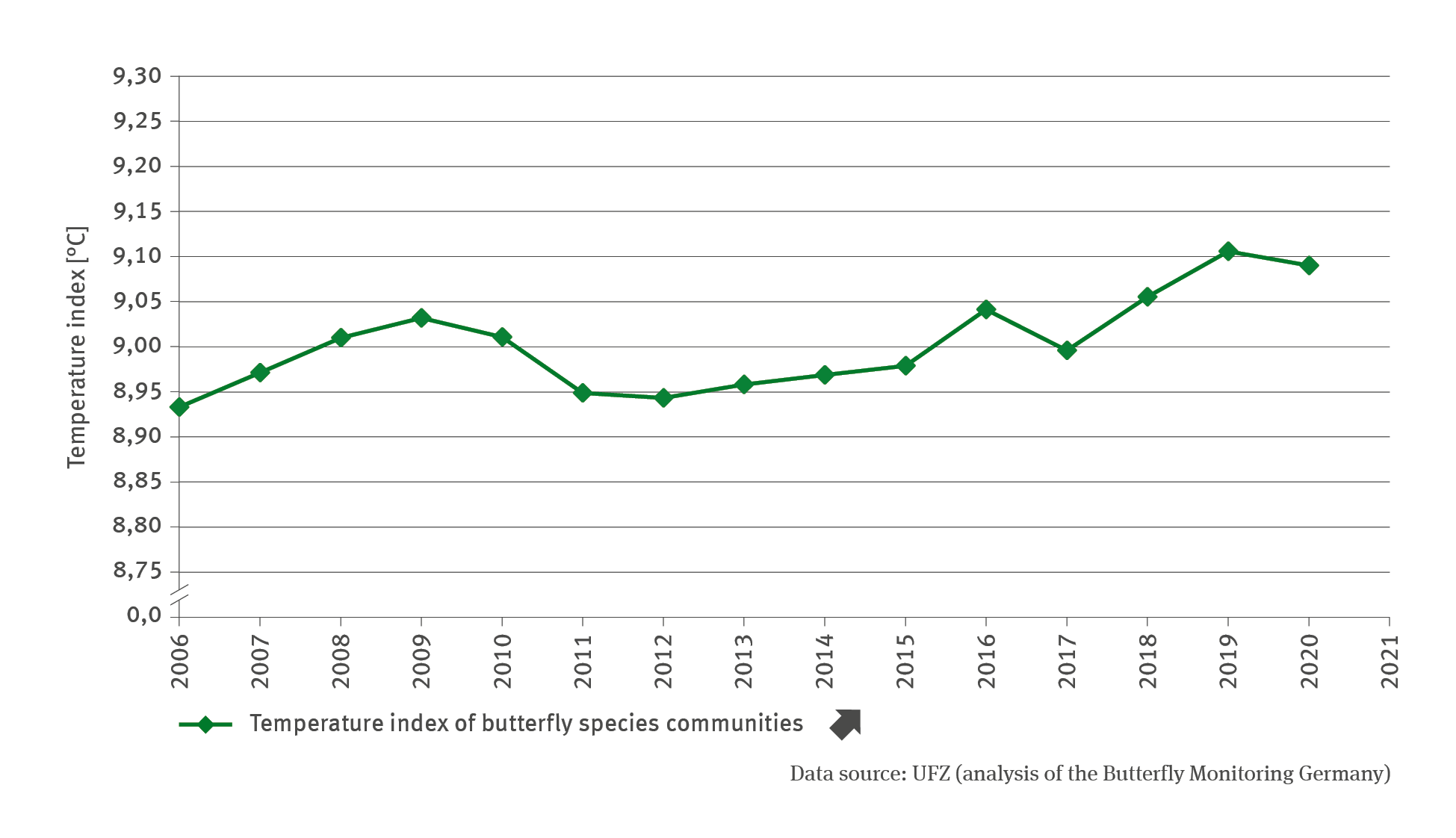
The temperature index of butterfly communities provides a vivid demonstration of such changes. It reflects the mean temperature requirements of the species present in a species community. In the period from 2006 to 2020 the index shows a significant increase. This means that thermophilic species in the species community have increased whereas psychrophilic species declined. Up to 2012 this development was somewhat ambiguous, whereas subsequently a steady increase in the index is evident. The above-average warm years from 2018 onwards favoured especially the thermophilic species thus entailing a distinct increase in the temperature index. As yet it is not possible to predict any long-term repercussions of these changes in terms of biological diversity.
In order to calculate the temperature index of butterfly communities, it was necessary to first calculate the mean temperature requirement value per butterfly species, which was derived from the average temperature prevailing in the European distribution range of the species within the reference period from 1971 to 2000. Subsequently, the mean was calculated for the index by weighting the species-specific temperature values according to each species’ frequency of occurrence. The input contained data for 71 frequent and semi-frequent butterfly species as recorded within the transects used by Butterfly Monitoring (Tagfalter-Monitoring) for Germany as a whole. An annual temperature index for the butterfly communities was calculated for each transect and used as a basis for calculating the mean value for Germany. An index value increasing over time illustrates a shift in frequencies in favour of thermophilic species.
It is not just butterfly communities that have been changing. Dragonfly and bumblebee communities respond in similar ways to increasing temperatures. Climate-change related changes in species communities were also documented for birds (cf. Indicator BD-I-2), fish (cf. Indicators FI-I-1) and plants. The development often varies from region to region. Especially in northern distribution boundaries of species and in mountain ranges, changes proceed particularly fast. Changes in the composition of species communities can also result from shifts in distribution ranges. One example is the southern small white butterfly (Pieris mannii) which occurs mainly in Southern Europe. Since its first occurrence in Germany in 2008 it has spread widely across the country. In many cases, the consequences of such processes remain to be researched. However, it seems safe to assume that particularly interactions between different organisms will change thus producing impacts on various ecosystem functions and services.