Skip to main content Skip to main menu Skip to footer

VE-I-1: High-water closures to shipping on the Rhine

The illustration VE-I-1 entitled ’High-water closures on the Rhine’ contains a grouped bar chart which shows closures to Rhine shipping owing to high water when the HSW was reached or exceeded at the gauges of Maxau (Upper Rhine), Kaub (Middle Rhine) and Cologne (Lower Rhine). The number of high-water closures is illustrated, covering the period from 1970 to 2010, and from 2011 to 2021 the aggregated duration of closures in days with reference to quarter-hourly measurements of water levels is shown.
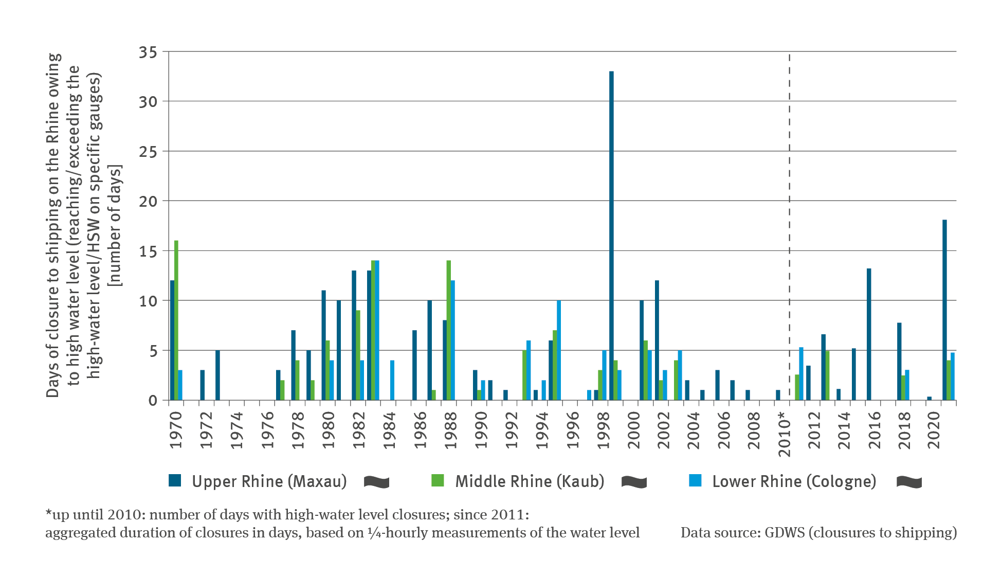
Source: Generaldirektion Wasserstraßen und Schifffahrt (closures to shipping)
Download image (120.56 kB)

The following contents contain this medium:

Tags

Short link: www.uba.de/m42748en