Skip to main content Skip to main menu Skip to footer

RO-R-6: Land use for settlements in officially designated flood plains

The illustration RO-R-6 ’Land use for settlements in officially designated flood plains’ contains a stacked column chart showing the number of municipalities by settled terrain in the flood plain of inland water courses. The settled area is shown as a percentage of an officially designated flood plain near an inland water course which is characterised by built-up settlement and transport areas.
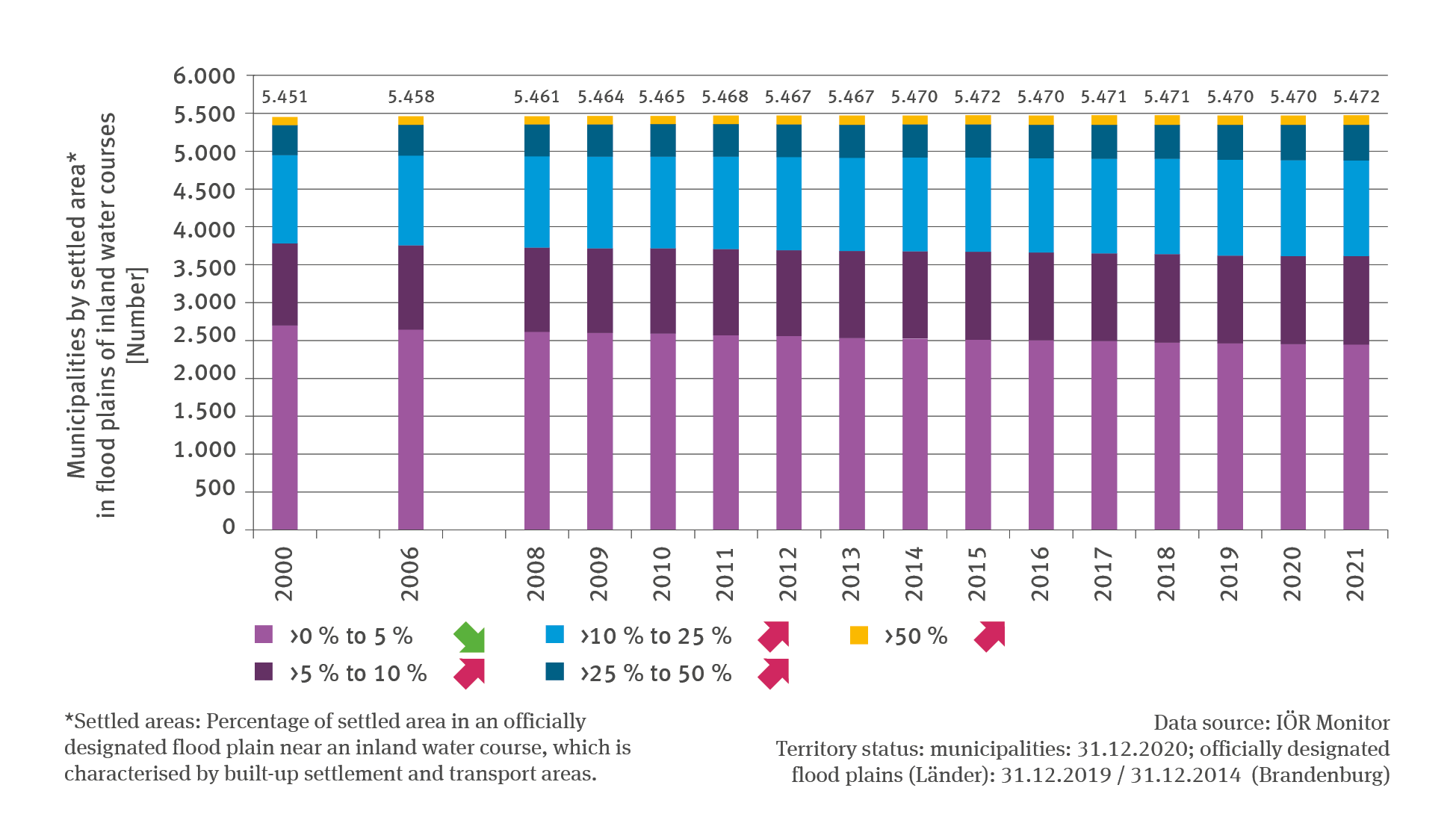
Source: IÖR Monitor Territory status: municipalities: 31.12.2020; officially designated flood plains (Länder): 31.12.2019 / 31.12.2014 (Brandenburg)
Download image (117.95 kB)

The following contents contain this medium:

Tags

Short link: www.uba.de/m42764en