Skip to main content Skip to main menu Skip to footer

FW-I-8: Forest fire hazards and forest fires

The line chart FW-I-8 ‘Forest fire hazards and forest fires’ contains two lines which indicate the development of terrain affected by forest fires in hectares and the mean number of days with fire reports in hazard categories (FWI 4 + 5) at stations in areas with very high to medium forest fire hazards. The terrain affected by forest fires suffered several distinct peaks in the period of 1991 to 2021. In 1992 the affected terrain comprised just under 5,000 hectares.
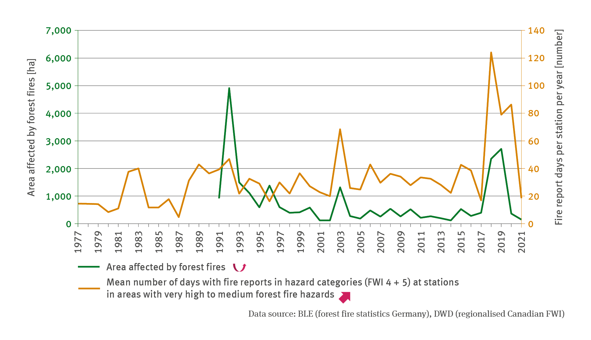
Source: BLE (forest fire statistics Germany)/ DWD (regionalised Canadian FWI)
Download image (161.16 kB)

The following contents contain this medium:

Short link: www.uba.de/m111686en