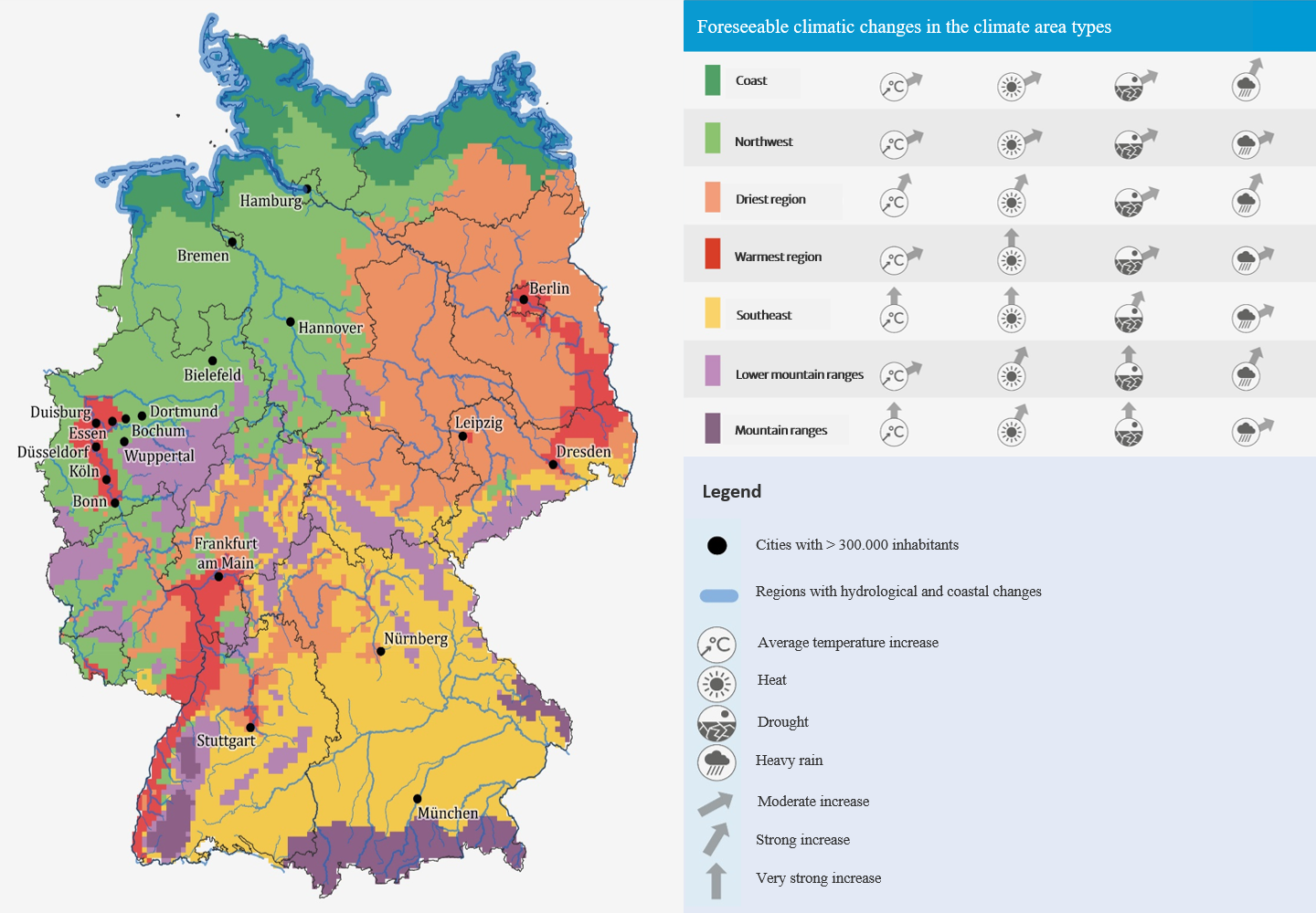
Climate area types show regions of Germany with similar climatic conditions. A statistical evaluation of the spatial pattern was used to determine seven types of climate areas. The graphic also shows how the climate in the respective region will change in the future with regard to specific climate indicators, and where major changes will occur.
Map basis: © GeoBasis-DE / BKG (2020), © EuroGeographics, Deutscher Wetterdienst, © European Union, Eurac Research
Source: KWRA 2021
Download image (1.13 MB)