In connection with climate change, it is a particularly important and increasingly essential task of spatial planning to make appropriate provision for potential risks. On one hand, spatial planning can help to steer the development of settlements deliberately into directions where risks associated with climate change either do not exist at all or exist only to a manageable degree. Besides, spatial planning can ensure that recognisably vulnerable areas are to be kept, as far as possible, free from any settlement activity. Relevant risks to be considered in planning processes include the sudden mass movement of materials such as rock falls, landslides or sinkholes as well as – in coastal areas and on islands – storm surges. Such hazards can increase regionally as a result of climate change, if extreme weather situations and weather patterns increase in both frequency and intensity.
In conjunction with the specific legal requirements to be observed in respect of flood protection, spatial planning must take special care to consider in its planning processes any flood hazards associated with rivers and streams, making certain that preventive flood protection is implemented resolutely.225 Progressive climate change goes hand in hand with changes in precipitation scenarios, thus increasing hazards connected with flood events: Such events can turn out to become more frequent, and the outcomes, as shown drastically in 2021, can be very serious (cf. Indicators WW-I-3, WW-I-4).
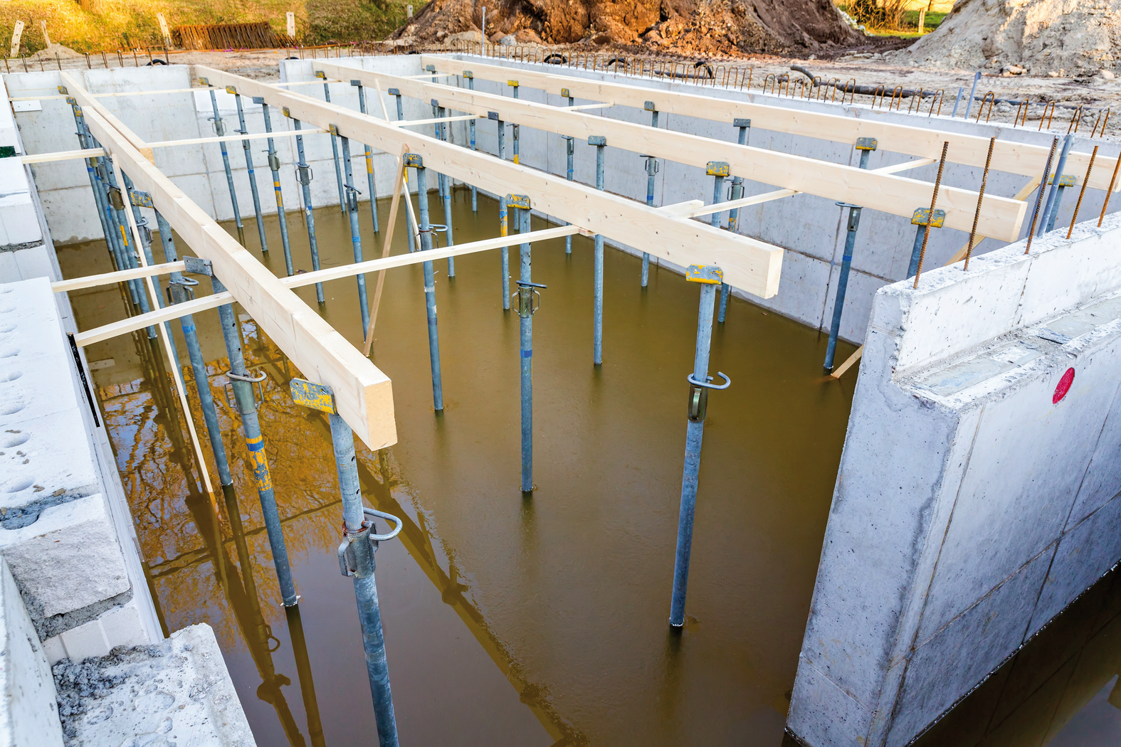
The course of flood events and their damage potential are considerably influenced by human activities, both in the past and nowadays. For example, in former times natural flood plains in many river valleys were eliminated by measures such as building dykes and river modification. Numerous watercourses were shortened thus increasing the flow rate of the rivers concerned. In times of flooding, the waters from many tributaries therefore now accumulate faster in a river bed; the resulting flood waves are often steeper than in the past and their travel times shorter. Consequently, there is an increased risk of damage from floodwater. Besides, valuable material assets were constructed in the shelter of dykes where the land was formerly available for rivers in terms of flood plains. If the flood protection provided proves inadequate when these settlements or industrial estates are flooded, the damage caused can in some cases be considerable (cf. Indicator BAU-I-5).
Nowadays, protection from flood events is covered by the German Water Resources Act in accordance with specifications contained in the regulations laid down in the HWRM-RL. Furthermore, as far as inland waterways are concerned, it is required in Germany in accordance with provident land use to stipulate binding specifications for flood plains on the basis of (statistically speaking) once-in-a-hundred-years flood events (HQ100); these specifications have to conform to specific protective rules. In such areas, both the allocation of urban development plans for new building locations in the outskirts, and the construction or extension of buildings, are either prohibited or permitted only in exceptional cases. Furthermore, it has been mandatory since 2018 that any flood formation areas be identified, and express permission is required for such areas where specific changes of land use such as conversion of grassland to arable land or conversion of alluvial woodland to another type of land use are proposed.
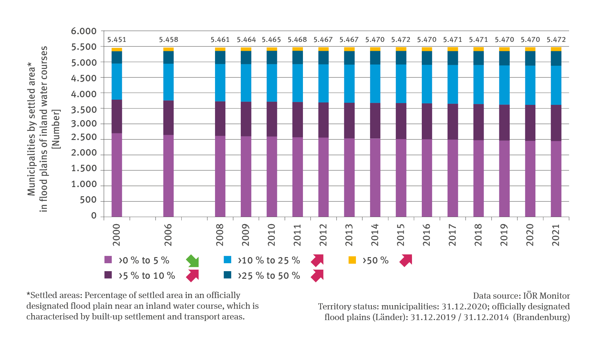
However, in the past many forms of developments such as transport areas, industrial and trade buildings as well as residential buildings had already been implemented in numerous flood plains associated with inland watercourses. For instance, according to the Monitor of the Development of Settlement and Open Spaces226 maintained by the Leibniz Institute of Ecological Urban and Regional Development (IÖR), in about half of municipalities of Germany buildings have been erected in parts of flood plains. Looking at the development over the past approximately 20 years, it is clear to see that – while the number of those municipalities overall remained relatively constant – there were changes in the distribution of various categories in respect of the extent of terrain used for buildings: The number of municipalities with less than 5 % of settlement and transport areas in flood plains declined significantly whereas this number increased significantly in all other categories. In other words, the increase in settlement and transport areas (cf. Indicator RO-R-5) does not refrain from targeting flood plains. On the contrary, the building activity in terms of settlement and transport areas in those municipalities shows an increase since 2000 by circa 100 square kilometres which is equivalent to growth by just under 13 %.
According to current legislation, any further expansion of building activity leading to settlement and transport areas in flood plains ought to be limited to exceptional cases. The continuous growth recorded in past years shows, however, that despite well-known flooding risks, the pressure to build in flood plains remains high. The statistics available do not allow any conclusions as to how many other hazards such as the mass movement of materials or storm surges are taken into account when land developments are contemplated. Nevertheless, it seems that efforts need to be redoubled, also in terms of spatial planning, regional and urban development planning, at least with a view to flood protection, in order to influence and exert provident control over land development.
225 - ARGE BAU – Bauministerkonferenz – Konferenz der für Städtebau, Bau- und Wohnungswesen zuständigen Ministerinnen und Minister und Senatorinnen und Senatoren der Länder (Hg.) 2018: Handlungsanleitung zur Hochwasservorsorge und zum Hochwasserschutz in der Raumordnungs- und in der Bauleitplanung sowie bei der Zulassung von Einzelbauvorhaben. 35 pp. https://www.bauministerkonferenz.de/Dokumente/42322160.pdf
226 - IÖR – Leibniz-Institut für ökologische Raumentwicklung (Hg.) 2022: Monitor der Siedlungs- und Freiraumentwicklung (IÖR-Monitor) – Indikator-Kategorie Risiko, Siedlungslast im Überschwemmungsgebiet. https://monitor.ioer.de/?raeumliche_gliederung=gebiete&opacity=0.8&zoom=6&lat=51.32374658474385&lng=10.458984375000002&time=2021&glaettung=0&baselayer=topplus&ind=R04RT&raumgl=gem&klassenanzahl=7&klassifizierung=haeufigkeit&darstellung=auto&ags_array=&