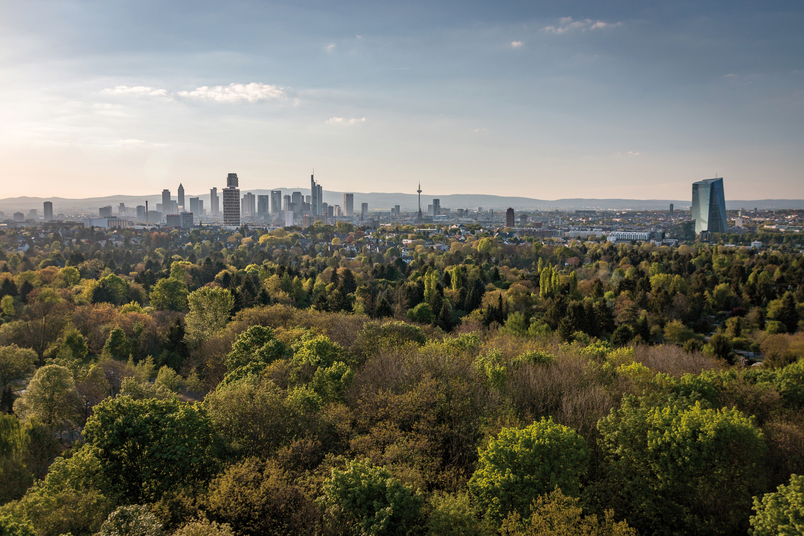
In towns and greater conurbations with high-density settlements and a high degree of sealed surfaces, it is common to measure distinctly higher average temperatures and higher peak temperatures than in their periphery – this effect is termed ‘urban heat island’ (cf. Indicator BAU-I-2). The intensity of heat island effects increases with increasing population density. In larger towns with approximately 100,000 inhabitants the temperature difference between town and periphery can be up to 6 °C. Depending on natural bio-climatic conditions (such as geographical aspect, altitude etc), this effect can in summer months give rise to increased heat stress in towns compared to the periphery, and climate change may lead to a future increase in the occurrence of this phenomenon. It is a fact that particularly town spaces cool down more slowly in the evening or at night compared to the periphery; this can cause difficulties to the population, when high temperatures do not make it possible to have a good night’s rest. For example, in the megacity of Cologne at the end of a clear night a difference in excess of 10 °C was recorded (cf. Indicators GE-I-1, BAU-I-1).
Regional planning is able to counteract this projected increase in bio-climatic stress situations by designating climatically important large-scale open areas as priority and restricted areas reserved for specific climate functions, where cool and fresh air accumulates, and by networking those priority and restricted areas with localised green spaces, thus permitting the passage of fresh air into urban spaces. In this way regional planning is able to prevent any land use which might counteract these objectives. Furthermore, planning can also be used to designate areas where – in view of local circumstances – specific action should be taken in order to reduce bio-climatic stress.
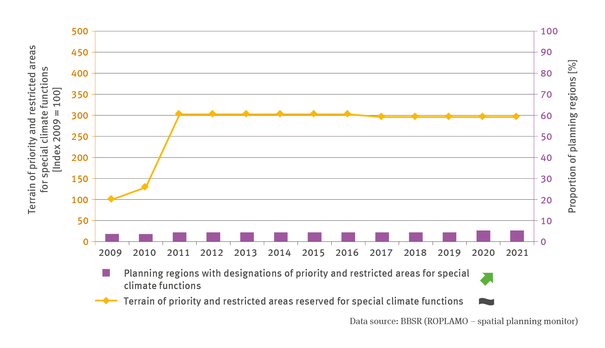
It is true to say, however, that hitherto the designation of priority and restricted areas for facilitating specific climate functions has materialised in very few regions. One reason for this is that this planning category is currently still relatively new whereas plans created at state and regional level typically remain in force for extended periods. Innovations therefore take time to establish themselves gradually as an integral part of such plans. Another reason is that regional planning also uses other spatial planning tools for the protection of open spaces, such as regional green belts for safeguarding such climatically important open spaces; alternatively, regional planning uses for example a symbolic approach by illustrating bio-climatically relevant ‘air channels’ without allocating tangible tasks to specific areas. Whatever tools are used and in what way they are employed, is also dependent on the designation practice adopted in the federal state concerned. This is why there may not be an additional requirement for the designation of specific areas.
The planning regions of Hesse, Rhineland-Palatinate and Saxony – where priority and restricted areas for specific climate functions were designated previously – both of the above-mentioned objectives are thus being pursued: Reserving climatically important open spaces and identifying bioclimatically stressed areas as being in major need of action. In Hesse regional plans have to fulfil the purpose of safeguarding areas sustainably so that they can serve as climate-balancing spaces or as air channels. In the regional plans for Middle Hesse and Southern Hesse areas are specified in detail where cool and fresh air accumulates and from where such air can be channelled elsewhere, in order to safeguard and – where necessary – restore such processes in these areas. These areas are to be kept clear of development or any other measures which might inhibit the accumulation or transport of fresh and cool air. Any plans and measures which might impair the aeration of locations exposed to climatic stress or air-quality stress are to be avoided in those areas. Their implementation is permitted only in cases where evidence can be submitted proving that no substantial detrimental climatic impacts would ensue.
The second approach within the planning category as outlined above has been adopted in the regional plan for Middle Rhine-Westerwald and in the regional land use plan for Frankfurt / Rhine-Main. In this case, thermally stressed spaces and climatically vulnerable valley locations are designated as restricted areas, partly with the objective to enhance the prevailing climatic conditions as much as possible. To this end, it is intended to conserve or expand climate-balancing areas or to avoid housing development projects which would impede the free passage of fresh air.