Skip to main content Skip to main menu Skip to footer

Mapping of 'problem areas' and 'non-problem areas' in Europe's seas

Eine Kartenausschnit Europas zeigt

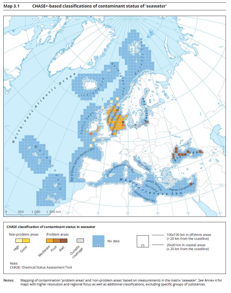
(based on CHASE-based classifications)

Source: European Environment Agency
Download image (141.33 kB)

The following contents contain this medium:

Short link: www.uba.de/m74372en