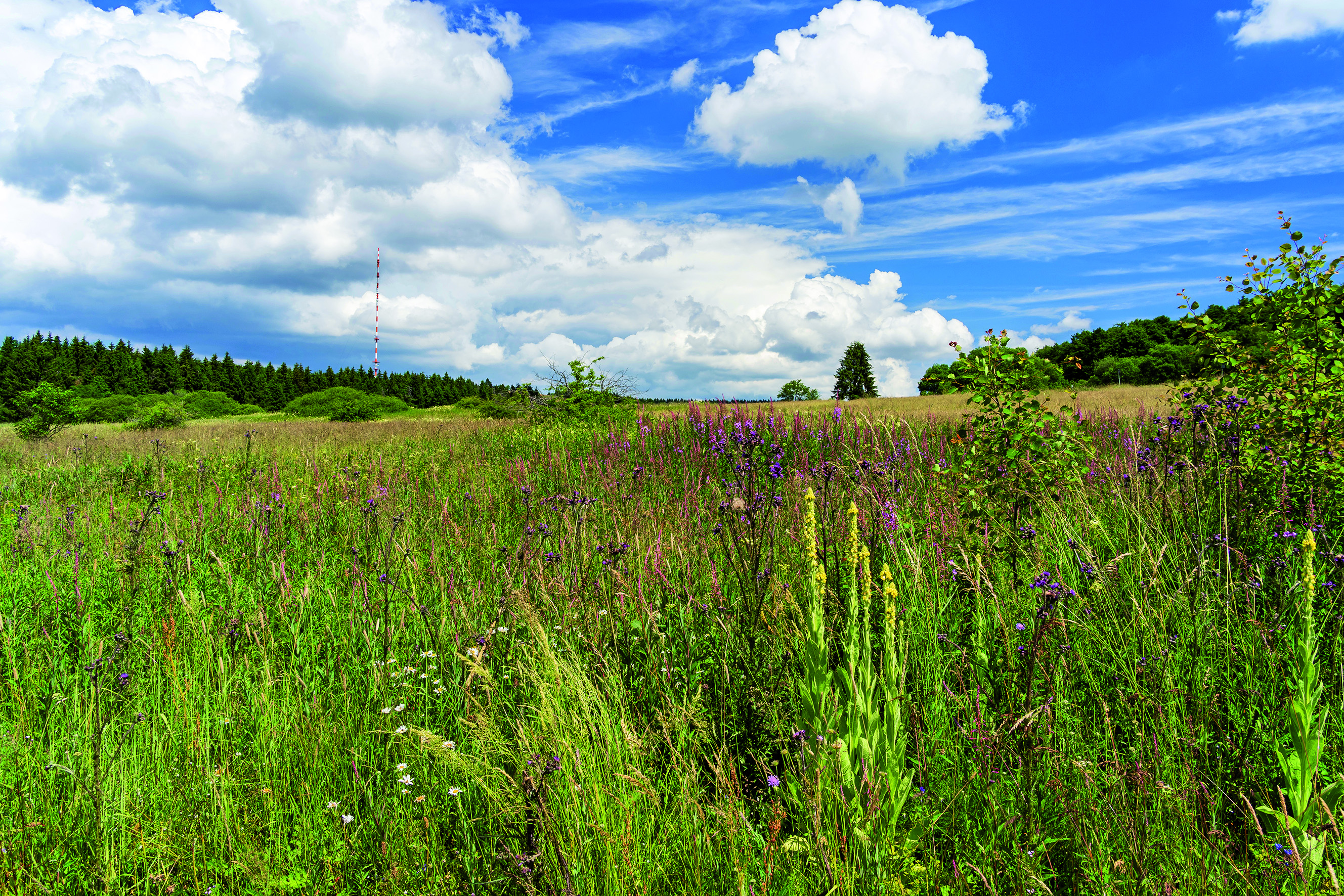
Climate change will alter the habitat conditions for animal and plant species over a large area. Higher temperatures and changing precipitation patterns as well as extreme events will affect various components of ecosystems, impacting functions such as the nutrient balance, habitat structures or the available food supply. Ultimately this means: that the boundaries of habitats of animal and plant species shift.
In these circumstances, a functioning compound system or network of biotopes is essential for the survival of specialised species which require specific locations and habitats. In a contiguous network of ecologically significant open spaces, species are able to explore and colonise new, climatically more suitable habitats of sufficient size and content. This is the only way to safeguard also the essential genetic exchange among different populations and distribution areas for the continued existence of species.
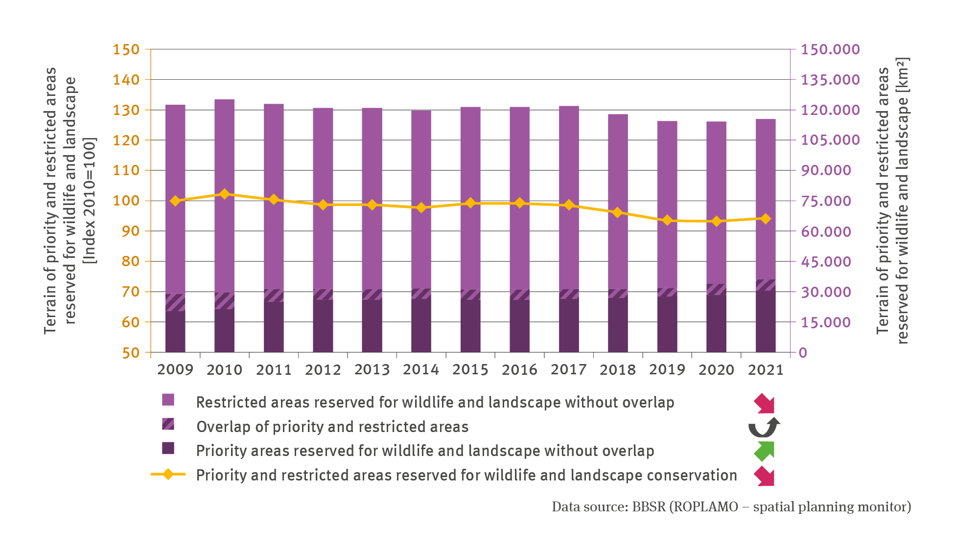
By designating priority and restricted areas reserved for wildlife and landscape, spatial planning can contribute to safeguarding the establishment of an ecological network by means of planning. This strategy enables the planning system to safeguard areas or to impose restrictions on their use, thus protecting the areas concerned from competing land use claims. In 2021 this was the case on slightly more than one third of the entire terrain of the Federal Republic of Germany: In that year, a total of circa 115,000 square kilometres were designated as priority and / or restricted areas. It must be borne in mind that the assessment combines various, partly heterogeneous designations applied in the Länder concerned. These include for instance spatial planning areas for the protection of wildlife, the protection of landscapes and landscape-related recreation as well as areas reserved for the development of an ecological network. This is why in some places, there is a degree of overlap between priority and restricted areas for wildlife and landscape, for example, when terrain is reserved as priority areas for species and biotope protection at the same time serving as a restricted area for the special protection of the landscape. In the time series concerned, these partial areas are included only once.
Despite temporary increases, the total of designated areas decreased between 2009 and 2021 by circa 7,000 square kilometres. This decline occurred at the expense of restricted areas and was essentially due to the fact that some designations imposed on restricted areas were revoked in the process of revisions. The number of new designations of restricted areas – predominantly imposed in other planning regions – was could only partially compensate for this decline. As in the past, more than 90 % of 114 planning regions nationwide still make use of the opportunity to designate priority or restricted areas for wildlife and landscape. Many regions make use of these categories by designating large-scale areas thus demonstrating that they attach great importance to the protection of wildlife and landscape thereby establishing and maintaining an ecological network.
However, these figures alone do not make it possible to gauge whether the ecological network actually meets its objectives and whether the landscape is indeed permeable for animal and plant species. Such an assessment would have to take into account, above all, how the designated areas are spatially distributed and how they are actually interconnected and what ecological quality they exhibit. Moreover, priority and restricted areas are not the only areas that are intended to safeguard ecological connectivity. The development and safeguarding of the biotope network is primarily an essential task in the remit of nature conservation bodies which, among other things, designate protected areas on the basis of nature conservation law; these bodies plan and implement the management of designated areas (cf. Indicator BD-R-3). These areas are also part of the biotope network. However, they are only taken into consideration for this assessment insofar as they are also designated as priority or restricted areas in terms of spatial planning. Spatial planning tools such as regional green belts and green corridors which can benefit ecological networks are not taken into account in this context either. This is because these areas can, for instance, might also open up the potential for the allocation of tasks such as recreational use which would run counter to the objectives of the biotope network.
Apart from beneficial effects, such ecological networks unfortunately also provide opportunities for less pleasing developments. It is expected for example that as a result of climate change, undesirable species introduced by humans will be able to widen their distribution range. Given the circumstances of climate change, it has become even more important now and for the future to address this problem by good management of ecological networks in order to prevent any developments from counteracting nature conservation objectives or at least to minimise their impacts.