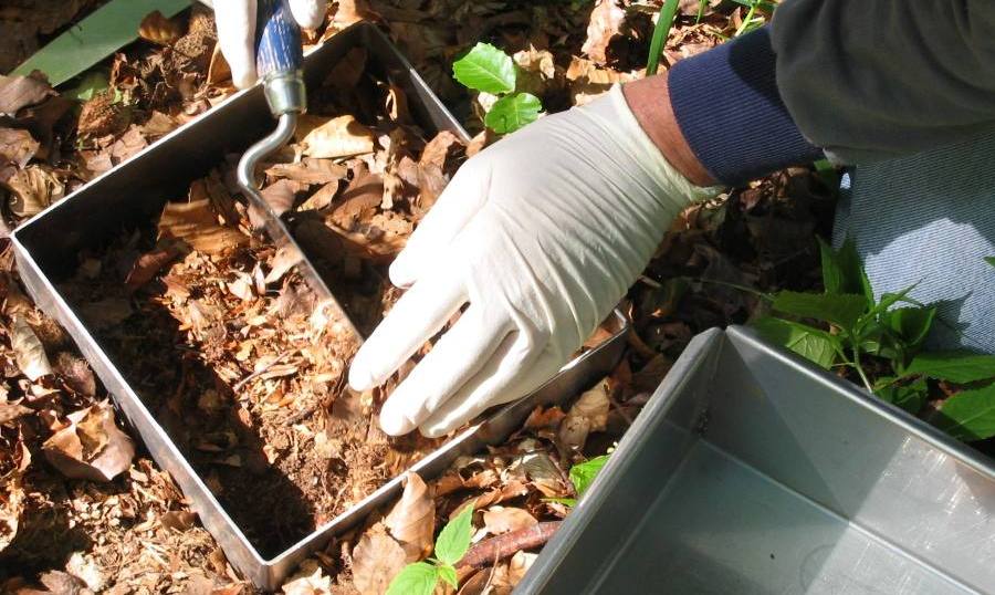
Click to enlargeDrills are normally used to gather soil samples.
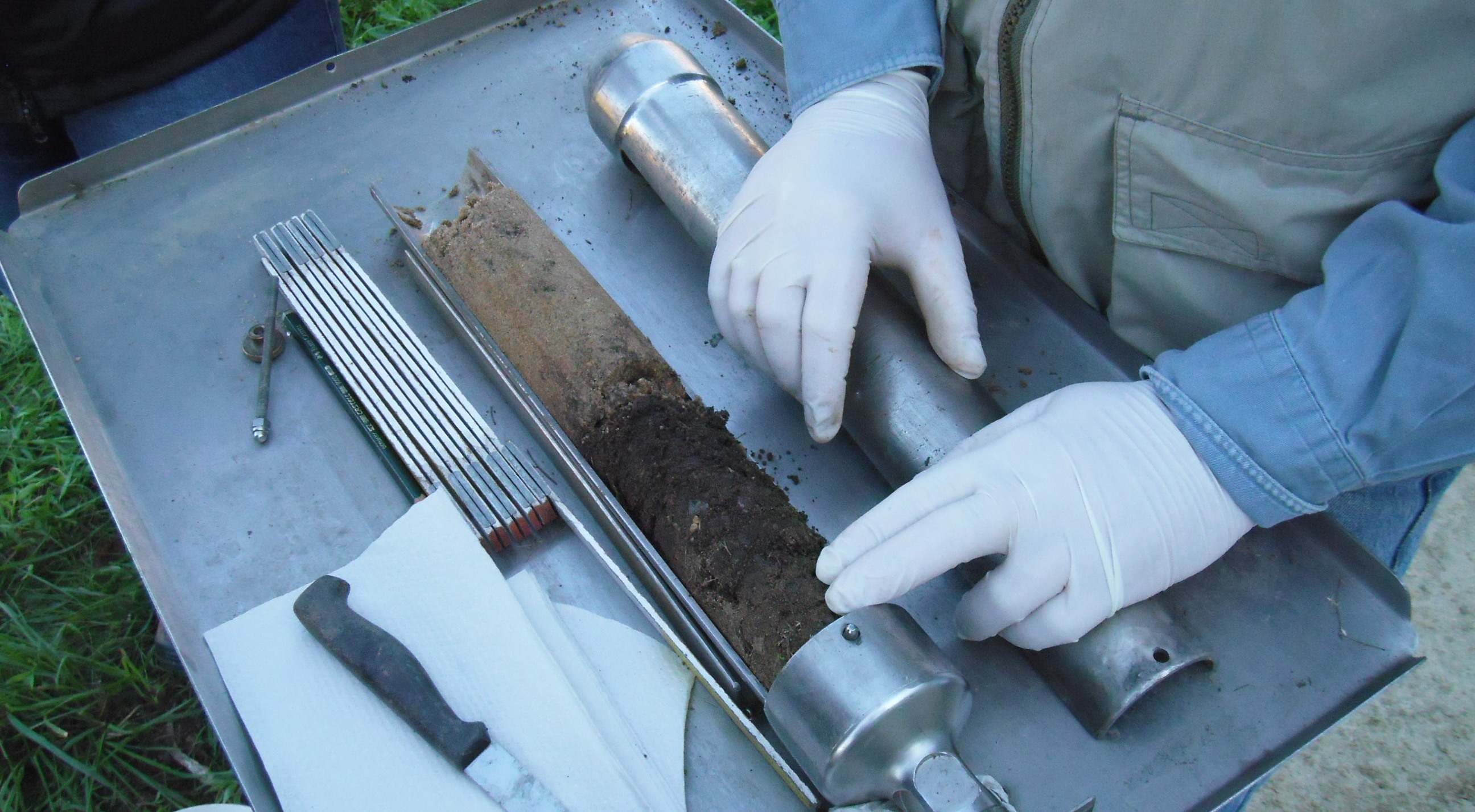
The environmental specimen bank regularly takes soil samples for the archive in Schmallenberg at eleven selected locations in Germany. This comes from Christine village.
Source: Umweltbundesamt
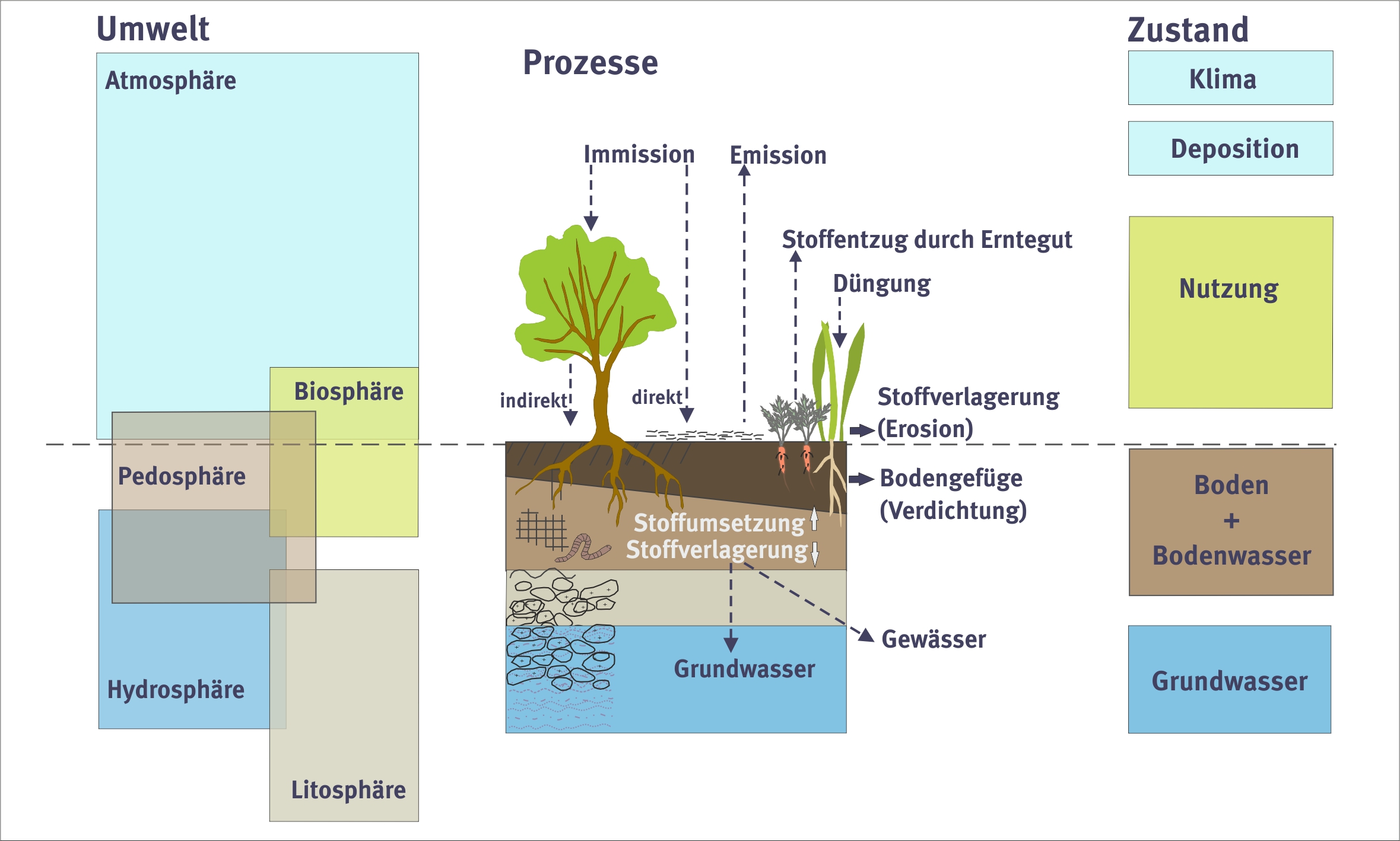
In order for soil to be reliably protected, its status must be monitored continuously over extended periods. Soil data allows for the early detection of soil status and function related changes and damage, which in turn form the basis for elaboration of the necessary measures. Following is a list of the main federal projects and instruments in this regard.
The status of Germany’s soils is continuously monitored over lengthy periods for cropland, grassland, forestry soil and special-use soils (e.g. for human settlements and winegrowing) – the goal being to determine current soil statuses, monitor changes therein over extended periods, and gain insight into emerging trends. Long term soil monitoring falls to the regional states. The data compiled via these monitoring programs is queried and used by the regional states and by UBA in connection with many issues. The accuracy of the various measurements improves with each measurement campaign. The UBA incorporates these measurements into a knowledge base, and has the option to carry out assessments for clusters of regional states.
Permanent soil observation is a key instrument of the environmental observation. Source: S. Marahrens / Umweltbundesamt
The measuring surface of a permanent soil observation is not marked in the field. Source: S. Marahrens / Umweltbundesamt
The BZE Wald and ICP Forest projects monitor and assess the statuses of forests and forest soils. The data obtained from this monitoring is used for purposes such as drawing conclusions concerning the soil carbon cycle, soil nutrient balances, soil water balances, and diffuse substance loads in the soil. The joint federal/regional-state agency known as the Bund-/Länder-Arbeitsgemeinschaft Bodenschutz (BZE) coordinates and manages measurement station establishment and operation, as well as minimum-parameter sets and investigation methods. The Federal Ministry of Food, Agriculture and Consumer Protection (BMELV) is in charge of the program. The Thünen-Institut/Institut für Waldökologie und Waldinventuren keeps this data in a central database and is in charge of coordinating and analyzing it. A national database is slated for rollout in 2015.
BFarmland-soil status characterization program
This program is the first nationwide program to promote consistent and representative inventories of carbon sequestration in the uppermost 100 centimeters of farmland soil. Thanks to the program’s nationwide network of 3,200 sampling stations, carbon sequestration in the soil of Germany’s cropland, grassland, horticultural land, and special-crops areas is measured. The main goal of this undertaking is to forecast the impact of climate change on soil carbon sequestration. The Federal Ministry of Food, Agriculture and Consumer Protection (BMELV) is in charge of the program. The Thünen-Institut/Institut für Agrarrelevante Klimaforschung is in charge of coordinating and rolling out the program.
Agricultural long-term field studies
As at September 2011, 40 long-term agricultural field studies were being conducted at 19 German sites, for the purpose of continuous investigation of issues such as fertilization, organic farming, substance life cycles and crop cultivation. Such studies are also essential for investigations of long term climate and farming related changes in soil properties such as soil humus content, nutrient content and carbon sequestration. These studies are set up and run by federal and regional-state agricultural research agencies, as well as by universities.
Federal environmental specimen bank
The federal environmental specimen bank allows for documentation and assessment of environmental quality, and provides the Federal Ministry for the Environment (BMU) with the scientific basis for carrying out and assessing the success of environmental protection and nature conservation measures. Since 2002, samples have been collected regularly at 11 selected sites across Germany. The federal environmental specimen bank is housed at the Fraunhofer Institut für Molekularbiologie und Angewandte Ökologie in Schmallenberg.
The litter layer of forest floors requires a special sampling. Source: Umweltbundesamt
German National Meteorological Service’s agricultural weather data
This service’s agricultural weather measurement program has been providing soil water content and temperature measurements since the 1960s, via around 500 measuring sites nationwide. This data, which is mainly used by farmers, chambers of agriculture, and agricultural research institutions, makes a major contribution to promoting ecofriendly soil use that is compatible with the relevant sites.
Soil estimates
Soil estimates involve continuous documentation of the properties and yield capacity of Germany’s farmland in a standardized fashion, based on a network of some 4,100 sample profiles (sample elements), as well as a prognostication framework for cropland and grassland. The data concerns soil properties such as soil type, humus content, rock content and root penetration depth. Crop yield capacity is projected using relative figures ranging from seven to 100, the goal being to obtain a standardized assessment basis for Germany’s arable land, as mandated by the Soil Estimation Act (BodSchätzG). Another key use of such estimates is for the determination of agricultural subsidies and the identification of agricultural and environmental policy measures.
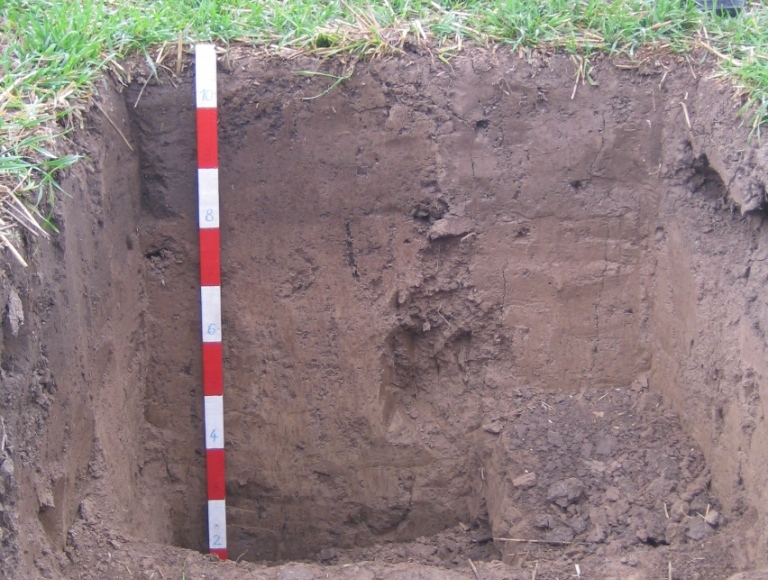
Soil profiles are dug up and examined for the estimation of soil. Source: S. Marahrens / Umweltbundesamt
The UBA’s motto, For our environment (“Für Mensch und Umwelt”), sums up our mission pretty well, we feel. In this video we give an insight into our work.
The UBA
Contact
Wörlitzer Platz 1 06844 Dessau-Roßlau GermanyPlease contact us exclusively by e-mail: buergerservice [at] uba [dot] de. Unfortunately, we are currently not available by telephone. There may currently be delays in answering enquiries. We ask for your understanding.
 Click to enlarge